It has been over 2 months since my last lesson, which was a “dual navigation exercise” in which my instructor and I planned a route and then flew it, from our little but increasingly busy airfield 20 miles or so north of Newcastle-upon-Tyne, up to Berwick-upon-Tweed and back.
Following on from this I would be expected to fly the route myself, completely alone.
Due to my instructor’s busy work schedule, the flight school booking system being harder to find empty slots in, and a family holiday to Zakynthos (which is an amazing place, you should go!) it had taken a while for the stars to align but finally I was back ready to fly again.
Planning
My lesson was originally booked for 11am, so I got up at the crack of 9 o’clock and started planning the route.
Shortly after planning it all out, my instructor sent me a message saying the cloudbase at the airfield was practically on the deck, and asked if I wanted to try at 3pm when he had a gap in his schedule. I had my mind set on flying today, so we rescheduled.
For those of you paying attention, I’ve never flown in the afternoon before! And it was turning out to be a beautiful afternoon.
On arrival at the airfield, I retrieved my freshly delivered Pooley’s 250,000:1 map for the Borders region with the line drawn between Eshott and the lighthouse at Berwick (a nice visual feature to aim for). Earlier in the day I’d used an aviation protractor* to measure the angle of the line I had just drawn.
* Looks and works exactly like a regular protractor but 3x the price.
The “true track”, or TRK(T), was 342 degrees, that’s the route over the ground that I’d (hopefully) travel. But I’d not be travelling over the ground, I’d be in the air, and air has a nasty habit of moving.
I pulled up the Met Office’s Aviation Briefing Service (a free service to non-commercial pilots) and loaded the “F214 Low level significant weather and Spot Wind charts”. This shows just how much the air is moving, at various altitudes and which direction. It also provides the temperature at various altitudes which is helpful for performance calculations (e.g. warmer air is less dense so less power and less lift).
As the north east of England sits between two of the spot wind readings, we average the two to get our Wind Vector (“W/V”), which for this flight would be a 10 knot wind from 240 degrees.
Using the CRP-1 flight computer, I found that this would give me a slight (1 knot) headwind on the journey to Berwick and calculated the drift angle as -7deg, giving me a true heading – HDG(T) – of 335 degrees. The variance from the Earth’s magnetic pole is 0.5 degrees West, so I took half a degree off, but on rounding it came back up to 335 degrees. That would be my magnetic heading – HDG(M).
I did the same calculation for the return journey calculating a heading of 169 degrees and a 2 knot increase in speed.
Checkout
As it had been a couple of months, my instructor wisely suggested that I take him up for a couple of circuits first, before I set off on my first solo navigation exercise. I agreed and headed out to the aircraft to do the walk-around and pre-flight checks.
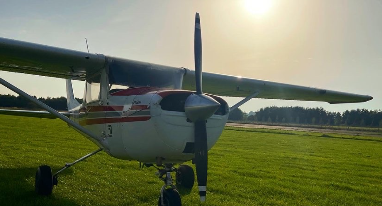
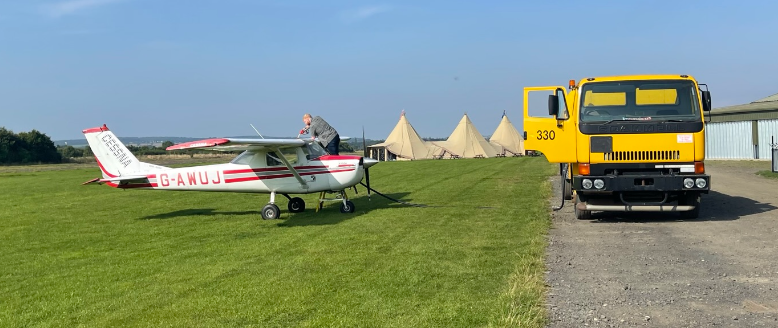
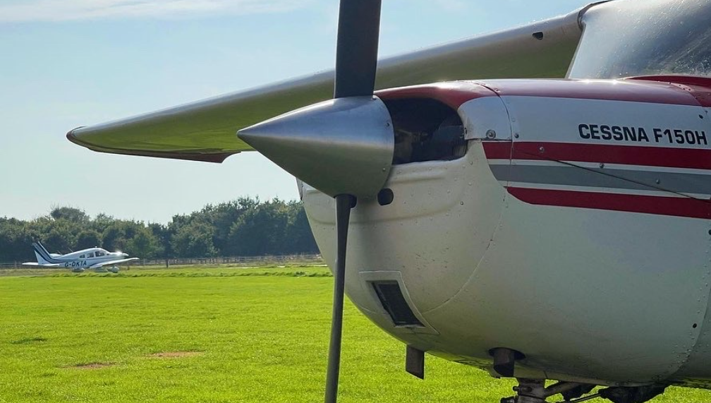
Approaching the aircraft, G-AWUJ, I noticed she was suckling at the teat of the fuel bowser. My instructor had asked one of the team to fill up the tanks just so I had maximum options and plenty of fuel in the event of go-arounds or diversions (which we briefed in-depth before I headed out).
I started the internal checks while the fuelling was completed and then performed the walk-around. She was in beautiful shape.
I leaned my weight on the rear fuselage until the nose-wheel was off the ground and spun the surprisingly light aircraft around so we could safely start the engine and taxi away from the fuel truck.
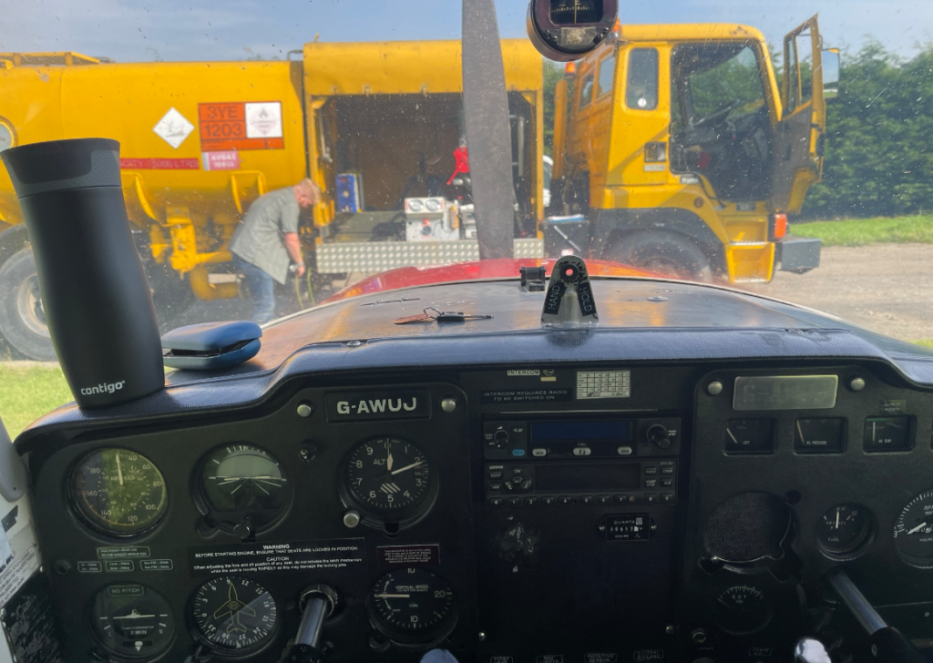
It wasn’t long before my instructor joined me in the aircraft, I started the engine and – absolutely sweating in the hot and humid 20 degree heat – made the radio call to start moving.
“Eshott Radio, G-AWUJ, backtracking runway one-niner to charlie.”
In fact, as I type this now, I realise I did not request a radio check at this point! I won’t forget that again in a hurry. And now you know why I excruciatingly write out each lesson!
As we started moving I noticed the windsock was completely limp indicating no wind. As we had just watched a beautiful white Piper PA28 (Cherokee) Dakota depart on runway 01, I made the decision to change to use that runway.
“G-UJ, changing to runway 01, backtracking runway 01 to Bravo.”
I did what I said I’d do on the radio, then ran through the power and pre-takeoff checks and taxied into position as my instructor closed his window which he had thankfully opened during the taxi to aerate the sauna / cockpit.
I pushed the throttle open and we started moving down the runway. I only needed a dab of right rudder to keep us on the centre line as i checked the RPMs were stable, engine temperatures and pressures were in the green band on the dials, and the airspeed was starting to come alive.
At 60 knots I gently pulled back on the controls and she lifted into the air. It took a while to get up to 300ft above the airfield level (aal), the hot day sapping both the engine’s power and the wing’s lifting abilities, and at 300ft I lifted the flaps up giving us a clean wing.
At 500ft I turned onto cross-wind, then onto downwind. I made the mandatory downwind radio call then ran through my BUMFILCH checks. As I got halfway through, my instructor said to make this a normal landing and we’d come up again if he wasn’t happy. I know this was to provide clear guidance of what to expect, but also the timing was to try and interrupt my checks – this is what I expect my examiner to do when I do my Skills Test.
I turned onto base and started to slow the aircraft down, I lowered two notches (20 degrees) of flaps and turned onto final, and I knew I’d messed up.
Approach #1
I was way too high.
“I’m high,” I said out loud and I pulled the throttle fully out to idle the engine, lowering the nose a little to maintain 60 knots (best glide speed). We still had a bit too much energy.
“Adding another notch of flaps,” I said, dropping the flaps to 30 degrees and lowering the nose again to maintain a safe airspeed in the glide.
That just about did the trick and we sailed over the runway numbers with about 10 feet of height still to lose. I raised the nose and the speed quickly bled off with the flap panels creating lots of drag. I held the wheels off the ground as long as I could and we settled onto the ground, more-or-less on the centre line. Not great, not terrible.
“I have control,” said my instructor. I took my hands and feet off the controls.
As he span us around and taxiied to the holding point he asserted the importance of not ending up on base too high. He was right, of course. We usually turn onto base when around 800ft above the airfield level (height or “QFE”), and then turn onto final at around 500ft. I was definitely high turning onto base.
Again, lesson learned.
The Door Incident
My instructor hopped out and left me to do my navigation exercise but as he walked away towards the clubhouse the door on his side popped open and I had to reach over and slam it shut.
This would be relevant in a moment.
Once I completed the after landing and pre-takeoff checklists I made the radio call and taxied back into position. In a few seconds I lifted off the runway again, and then the door popped open once again.
Aviate, navigate, communicate… then deal with the door.
Good airmanship
The door being slightly open didn’t have a noticeable effect on the aircraft. At full power in a climb, as I was, the spiralling airflow from the propeller hitting the upright tail fin induces a left-turning moment anyhow, so you need to push the right rudder pedal to counteract this and fly straight. Any additional drag on the right side would only be helping me stay straight.
At 300ft I raised the flaps and as I waited for 500ft to arrive on the altimeter (700ft in fact, as I had switched from QFE for the circuit, to QNH for the navigation exercise, and the airfield elevation is 197ft) I reached over and tried to slam the door shut. It didn’t work.
I turned onto crosswind and weighed up my options. I didn’t fancy doing a 1 hour navigation with an open door, and considered coming into land to sort the door and trying again.
With the airfield out my left window, I reached over to give it one last slam.
This time it clicked shut and I continued to climb. Turning onto downwind I was already at 1,500ft – the altitude I had planned to fly the nav due to some remaining haze in the air above after that morning’s fog.
I turned to fly directly over the airfield which is where the navigation would begin and made a radio call, “G-UJ, leaving the circuit to the north.”
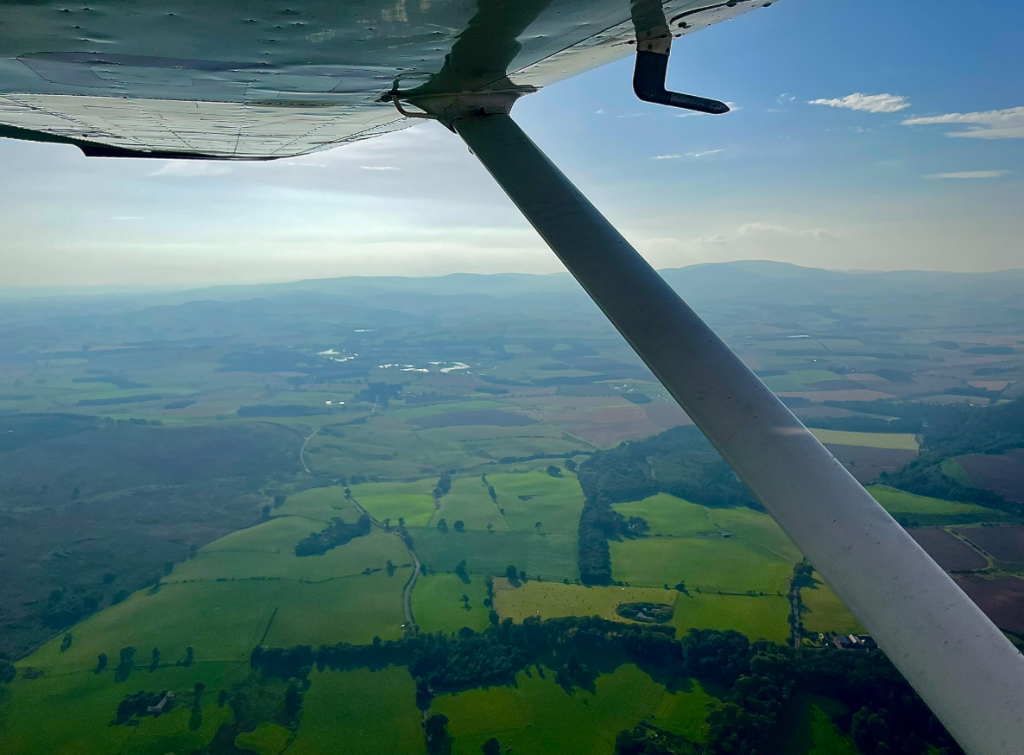
I steered onto my planned magnetic heading of 335 degrees. The air was smooth as silk and Northumberland looked stunning in the afternoon summer sunlight.
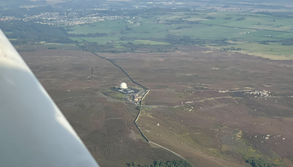
My first visual reference point was a ‘golf ball’ radar station on top of a hill overlooking the ancient market town of Alnwick. If my planned route and wind-correction was right I’d fly to the left of the golf ball and to the right of the small rural village of Abberwick.
As I came alongside the golf ball I notified the traffic around Eshott that I was switching to Newcastle Radar, however, I didn’t plan to speak to them.
Outside of controlled airspace, which includes most of Northumberland including all of the route on this exercise, you don’t need to speak to anyone at all. However, several major airports provide a service called the Lower Airspace Radar Service or LARS which offers optional radar coverage and information services to aircraft flying under 10,000ft.
I opted not to get a ‘Basic Service’ from Newcastle Radar for this flight simply because I was so far outside of controlled airspace and as the summer holiday rush was still underway, the air traffic controllers were very busy on the frequency. So instead I used the ‘listening squawk’ of 3737 to let Newcastle know I was listening in if they wanted to contact me for any reason, e.g. convergence with IFR traffic, but happy to accept my own responsibility for keeping safe and out of the way of traffic.
Even a basic service doesn’t promise any kind of traffic warnings and a listening squawk is a lesser option than this, so either way I knew what I was accepting.
I continued to cross-reference my over-the-ground track (“course”, for my US readers) against the line on the map I’d drawn earlier, making small corrections as I went, and eventually Berwick-upon-Tweed came into view. I resisted the urge to point my nose directly to Berwick as the wind would have blown me out over the sea, and tracked true towards the lighthouse.
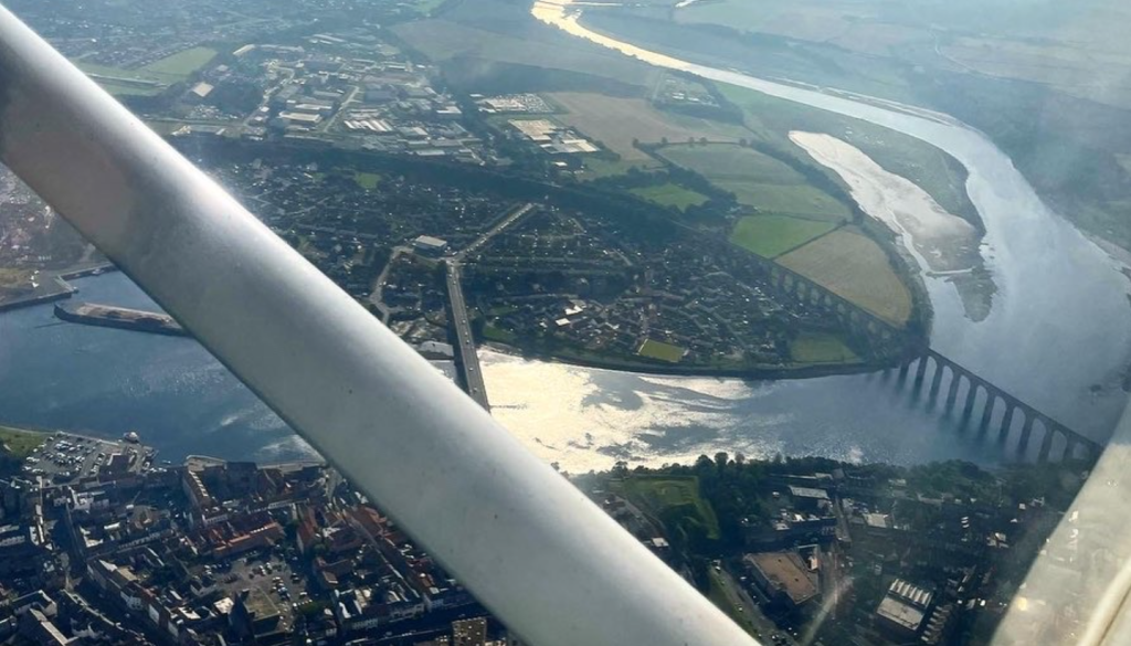
I made a 180 degree turn over Berwick and made a note of the time – 1523 UTC, or 4:24pm local – and recording the time from the stopwatch hanging around my neck – 20 minutes and 30 seconds almost exactly. This meant I was 2 minutes early, suggesting either inaccurate speed control or variation in the wind vs forecast. Probably a combination of the two.
I steered onto a heading of 169 and ran through my FREDA check:
F – Fuel, quantity as expected, fuel cock still on, mixture still appropriate
R – Radio, still tuned to Newcastle Radar, with Eshott’s frequency on standby ready for rejoining, squawk still on 3737
E – Engine, temperatures and pressures all in the green, ammeter showing positive charge and the suction gauge showing 3-5″ of vacuum pressure. At this point I also pulled out the carb heat for 10 seconds to check for ice in the carburettor.
D – Direction, I checked the direction indicator against the magnetic compass and realigned them.
A – Altitude, I checked I was flying on the latest QNH and my altitude was sufficient for obstacle clearance. In fact, at this point I decided to climb to 2,000ft as the haze had lifted substantially and there were a couple of radio masts that reached uncomfortably high into the sky along the route.
After a couple of minutes I noticed I wasn’t moving very much away from the coast line and this didn’t match with the route on the map – I should have been diverging from the coast and heading in-land. I checked my direction indicator against the magnetic compass and now there was a 20 degree difference. I’m not sure why as I’d only just realigned them after turning at Berwick, but my assumption is that the magnetic compass was still settling after the turn and I’d aligned too soon.
Regardless of why, continuous checks of position against the map and gross-error checks such as “I should be moving away from the coast not staying next to it” are done to catch these situations. I turned right 40 degrees to steer towards the track, then 20 degrees left after a couple of minutes to pick up the route again. No harm, no foul. As ever – lessons learned.
The flight back to Eshott from Berwick was genuinely a joy, with the sun starting to turn orange and the pilots of various airliners leaving and arriving at Newcastle speaking in my headphones. It was a very enjoyable time and sitting there on my own in command of an aircraft on a 60 mile trip, I started to feel like an actual pilot, not just a student pilot.
Approach #2
As I passed the golf ball again, this time on the left side of the aircraft, I changed my squawk code back to the VFR conspicuity code of 7000 and switched to Eshott’s radio frequency.
“Eshott Radio, G-UJ, 2 miles west of Alnwick, 2000ft, joining overhead.”
I heard two other aircraft in the circuit and knew I’d need to integrate into that traffic.
As I approached the airfield I saw one aircraft on downwind and another was just on final approach, descending towards runway 19.
“G-UJ, overhead, descending deadside,” I said, pulling out the carb heat and reducing the throttle to begin my descent to 1,000ft QFE (above airfield level).
The aircraft that was on final did a touch-and-go and started climbing out again, I let them get out of the way and turned crosswind overhead the ’01’ numbers which I’d started my take off roll twice already.
I then turned onto downwind and let everyone know on the radio where I was, ran through the BUMFILCH checks and started to configure for landing – flaps 20, 1500rpm, descending through 800ft, turn onto base (lesson learned from earlier!), then at 5-600ft turn onto final, lined up nicely with the extended centre line and – as the wind was negligible – let the aircraft do most of the work as I only really had to monitor the descent rate with occasional adjustments to the power setting. At 50ft I closed the throttle, crossed the threshold at around 5ft and 55kts, gently raised the nose and held the wheels off the runway while the speed and energy bled out of the little Cessna, and the main landing gear wheels rolled gently onto the tarmac.
Not a bad end to a very enjoyable flight.
I parked the aircraft and shut her down. Then I noticed something absolutely gobsmacking.

Tiger Flights
One of the many businesses operating from the airfield is Tiger Flights, a pleasure and tour flight operator with two Tiger Moth biplane aircraft. The second one having just arrived.
And she was unmissable.
Recently refurbished, she looked brand new, despite being built in 1941, making even the Cessna seem like modern technology by comparison.
And to top it all off, she wore a bright red paint job which glowed in the afternoon sun.
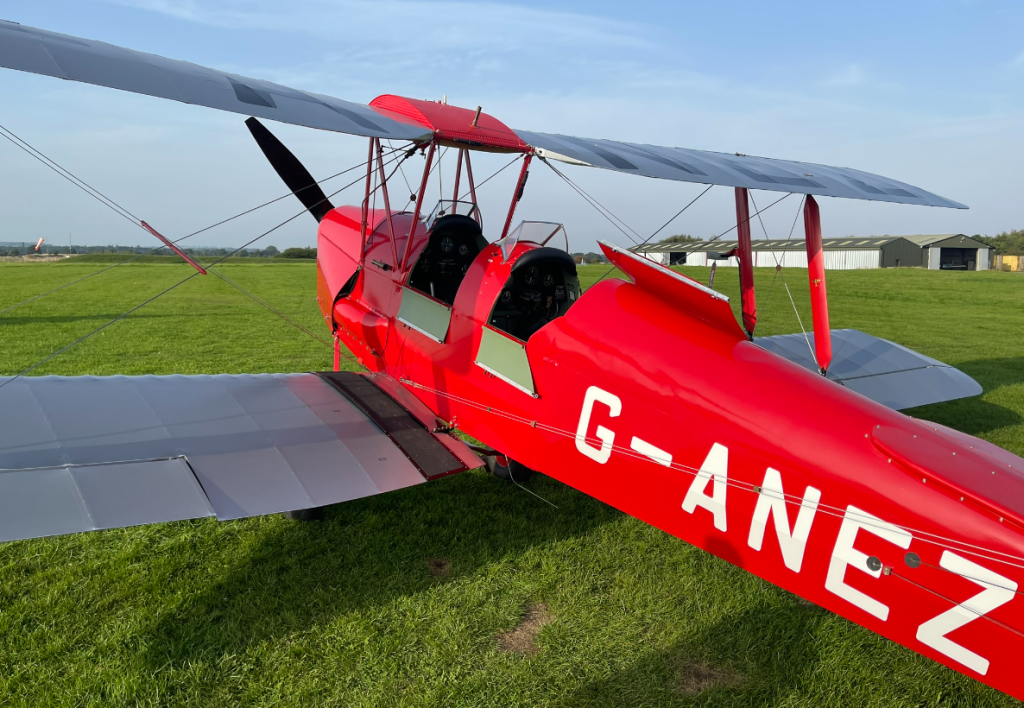
Such a good looking bird. And if you’re in the area and wanted to take a flight in bright red “Annie” or her sister Gems then head over to the TigerFlights instagram page where you can find out all the info you need. Tell them Chockhoway sent you and I might get a discount :D!
Next lesson my instructor and I will be heading south through Newcastle Airport’s controlled airspace on another dual navigation lesson. Stay tuned!